If you want to fully experience Japan’s natural scenery, wind, and light, we recommend walking in places rich in nature – hiking. On this page, we present 15 of the best hiking trails. Narrowing it down to 15 like this is difficult. This is because there are many places in Japan that are rich in nature. However, these 15 spots are really very nice, so please come and visit us. Most of the 15 spots are easy to reach. However, there are also hard courses such as Mt. Fuji and Oze. Please choose according to your purpose.
Click on each map to see nearby tour and activity information on a separate page.

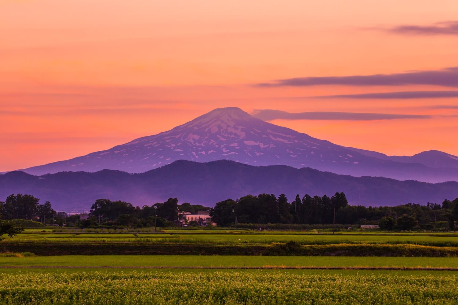

Table of Contents
- Best hiking trails: Shiretoko Goko Lakes (Hokkaido)
- Best hiking trails: Daisetuzan (Hokkaido)
- Best hiking trails: Oirase Stream (Aomori Prefecture)
- Best hiking trails: Oze (Gunma Prefecture)
- Best hiking trails: Nokogiriyama (Chiba Prefecture)
- Best hiking trails: Mt.Takao (Tokyo)
- Best hiking trails: Mt. Fuji (Shizuoka Prefecture, Yamanashi Prefecture)
- Best hiking trails: Kamikochi (Nagano Prefecture)
- Best hiking trails: Fushimi Inari Taisha Shrine (Kyoto)
- Best hiking trails: Kifune (Kyoto)
- Best hiking trails: Kumano Kodo Pilgrimage Route
- Best hiking trails: Koyasan (Wakayama Prefecture)
- Best hiking trails: Mt. Misen (Hiroshima Prefecture)
- Best hiking trails: Takachiho Gorge (Miyazaki Prefectue)
- Best hiking trails: Yakushima Island (Kagoshima Prefecture)
Best hiking trails: Shiretoko Goko Lakes (Hokkaido)
Shiretoko National Park located on the Shiretoko Peninsula in eastern Hokkaido = shutterstock
Tour Programs of Shiretoko
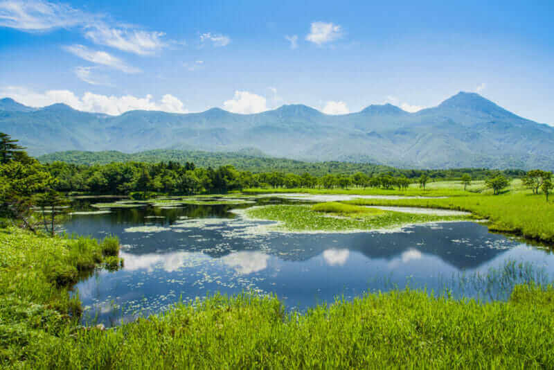
In the eastern part of Hokkaido there are a lot of unspoiled nature. Particularly beautiful areas are protected as “Shiretoko national park”. “Shiretoko Goko Lakes” is in this national park. Here you can enjoy wonderful hiking.
The Shiretoko Goko lakes are spreading at the foot of the mountains of the Shiretoko Peninsula. The virgin forests continue in the vicinity of those lakes that have not been developed at all. In this beautiful nature new promenades are being developed. There are two kinds of boardwalks. One is an elevated walking path above the wetland. Brown bears will never come because they are elevated and further electric fences are installed. You can stroll with peace. The other is a boardwalk within the virgin forest. There is a danger that brown bear will be approaching here, so depending on the time it is obligatory to walk with the guide.
Recently, a special tour began in Shiretoko Goko Lakes even in winter. For this guided tour, reservation is absolutely necessary.
>>Find the best deal, compare prices, and read what other travelers have to say at Tripadvisor!
Best hiking trails: Daisetuzan (Hokkaido)
View of top of Mount asahidake (highest mountain of hokkaido,japan). it is located in the northern part of the Daisetsuzan National Park = shutterstock
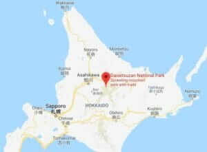
Tour Programs of Daisetsuzan
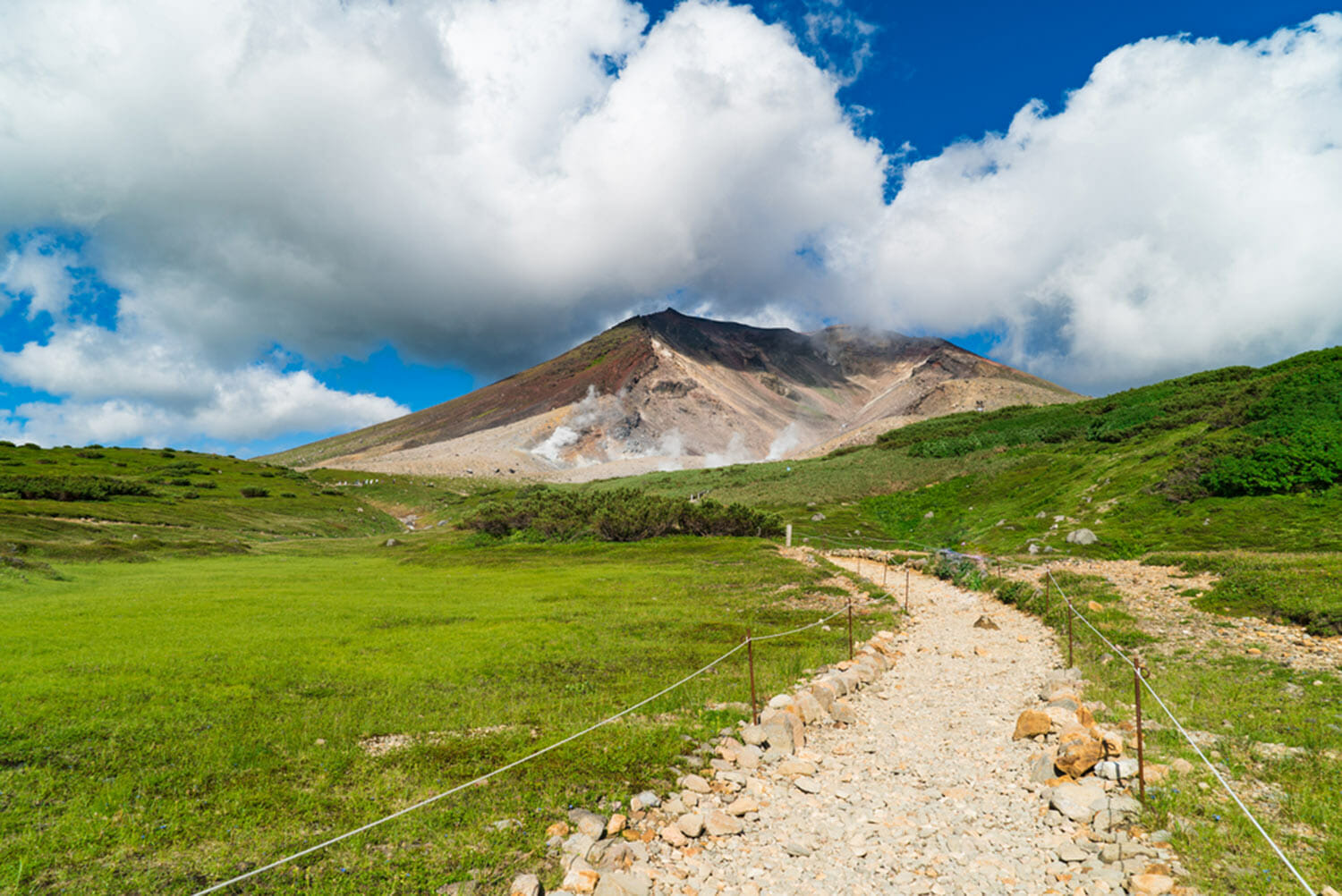
Daisetuzan (also called Taisetsuzan) is a vast mountainous area in the middle of Hokkaido. There are many mountaines with altitudes of around 2000 meters such as Mt. Asahidake (altitude 2291 m) and Mt. Kurodake (1984 m). Here you can enjoy hiking from June to October. There are two courses I recommend to the first person. Both are using the ropeway and enjoying the high mountain hiking.
The most popular is the course to use Kurodake Ropeway. This ropeway connects from Sounkyo Gorge, Hokkaido’s foremost spa town, to Mt. Kurodake’s 5th stop in 7 minutes. In addition, a pair lift is operated to Mt. Kurodake’s 7th line (1520 m). It is approximately 1 hour and 30 minutes on foot from the end point of the lift to the top of the mountain. From the beginning of July to the middle of August every year you can see the flowers of beautiful alpine plants.
The other course is to use Mt.Asahidake’s ropeway, the highest peak of Daisetuzan. This ropeway ties from Asahidake Onsen (1100 m) at the foot of Mt. Asahidake to Mt.Asahidake’s 5 th stop (1600 m) in 10 minutes. From the end point, a walking path to a beautiful pond called Sugatami Pond is being developed. A lap is about 1.7 km. I would like to recommend you a stroll especially to this Sugatami pond in Daisetsuzan first.
>>Find the best deal, compare prices, and read what other travelers have to say at Tripadvisor!
I also introduce Daisetsuzan in the article on autumn leaves below.
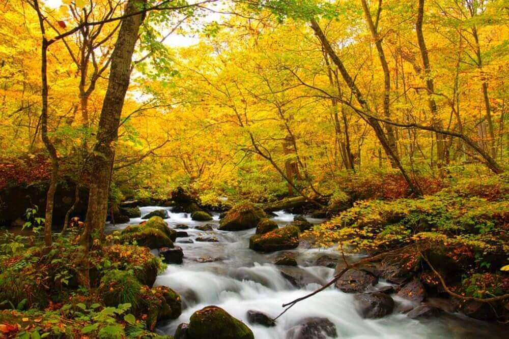
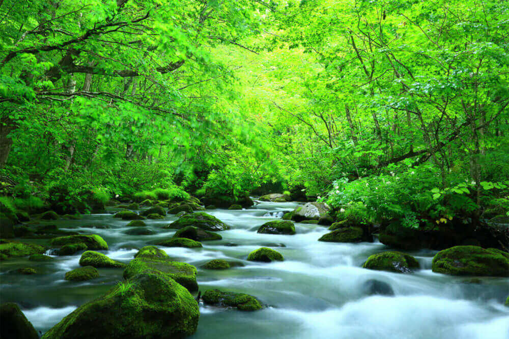
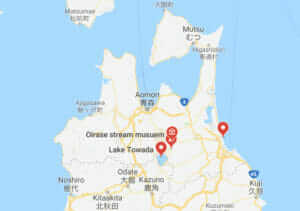
Best hiking trails: Oirase Stream (Aomori Prefecture)
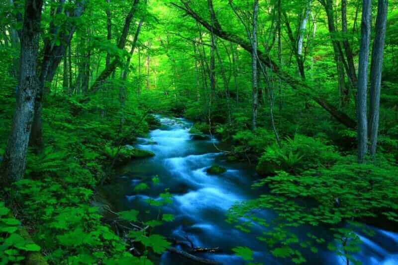
Oirase stream of fresh green = shutterstock
Tour Programs of Oirase Stream
Oirase Stream is a mountain stream starting from Towada Lake in Aomori Prefecture. I already mentioned about the Oirase Stream in the above article on autumn leaves as well as Daisetsuzan, so please refer to the above article for details. Oirase Stream creates a really wonderful forest and water world for about 14 kilometers from Towada Lake. Besides the time of autumn leaves, fresh green is also beautiful in the spring. I strongly recommend Oirase stream as a hiking spot.
>>Find the best deal, compare prices, and read what other travelers have to say at Tripadvisor!

Best hiking trails: Oze (Gunma Prefecture)

In Oze, the flowers of white skunk cabbage will welcome you in spring = shutterstock
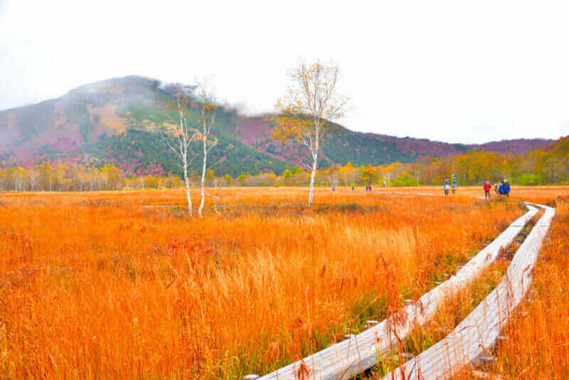
Oze national park in autumn,Japan = shutterstock
Tour Programs of Oze
Oze is a national park about 150 km north of Tokyo. If you cross the pass and reach Oze, you surely will be surprised by its beauty. It is a plateau (altitude of about 1,400 meters) closed by being surrounded by mountains over 2000 meters in altitude. There are no buildings made by humans, except for the walkway that was set up so that humans do not stepping directly on the wetlands. As in the photo above, in the spring, the flowers of pure white skunk cabbage bloom. In the summer, yellow flowers called Nikko Kisoge color the plateau. And in the autumn the splendid autumn leaves cover the plateau as shown in the second picture. Oze is a world where the scenery changes beautifully by the change of the four seasons.
For those who go to Oze for the first time, it is common to enter from the pass called Hatomachi-toge. First you will walk through the beautiful beech forests and proceed for a while. Then a vast wetland eventually appears in front of you. Walk through the wetlands promenade and take a picture there. Then you will take a break in the hut and finally return to Hatomachi-toge. This route is about 15 km in total, the time required is about 7 hours. The height difference is about 200 meters.
>>Find the best deal, compare prices, and read what other travelers have to say at Tripadvisor!

Best hiking trails: Nokogiriyama (Chiba Prefecture)
Nokogiriyama mountain in Chiba Prefecture, Japan = shutterstock
Tour Programs of Nokogiriyama
Nokogiriyama (Mountain of Sawteeth) is a mountain of altitude 329 meters on the Boso peninsula west of Tokyo. This mountain is not high in altitude, but there is an observatory stand “Jigokunozoki (meaning a place to see hell)” sticking out to the sea. It is very thrilling to look down from there.
This whole mountain is on the precinct of the Nihondera Temple and there are also large Buddha statues. In addition, from this mountain many stones were cut out for many years. Even now, there are walls cut vertically to cut stones. For these reasons, Nokogiriyama has become known as a very unique tourist attraction among foreign tourists in recent years.
You can go by car to the top of the mountain. You can also go by the ropeway halfway. However, if you are a fitness person, I recommend that you hike from the foot to the summit. There are many routes to climb this mountain. Please change route by going and returning, watching the Buddha statues of Nihondera Temple, go through the stone cut out traces and enjoy this mountain from various angles.
It takes about an hour to walk from the foot of Nokogiriyama to the summit. Although the altitude is not high, it is quite hard because there are many stairs and slopes that are rapidly grading. From the summit you can see the Tokyo Bay and Mt. Fuji. However, in order to see such a view from Jigokunozoki, you may have to line up. Let’s spare time considering crowding.
>>Find the best deal, compare prices, and read what other travelers have to say at Tripadvisor!
Best hiking trails: Mt.Takao (Tokyo)
People trekking at Mount Takao (Takao San), Tokyo, Japan = shutterstock
Tour Programs of Mt.Takao
Mt. Takao is a mountain with an altitude of 599 meters, about 50 kilometers west of Tokyo center. Although the altitude is not high, it is very popular as a mountain where you can easily go from the downtown area, and the number of mountaineers reaches 2.6 million people per year. It is said that Mt. Takao is the mountain with the largest number of mountaineers in the world.
In order to go to Mt. Takao, you should board the Keio Line from Shinjuku station in Tokyo. To the Takaosanguchi station it is approximately 50 minutes by express train on the Keio Line. There is Mt. Takao’s climbing mouth 5 minutes on foot from Takaosanguch station. It’s about 1 hour and 30 minutes from here to the summit. However, Mt. Takao also has cable cars and lifts. You can reach the altitude of about 470 meters using either a cable car or a lift. If you go this route, you can go from the foot to the summit in an hour.
There are huge trees around the road. In front of the mountaintop there is a temple called Yakuo-in. Mt. Takao has long been regarded as a sacred place centered on this temple. Yakuo-in has statues of demons called Tengu. Tengus are protecting this temple and the mountains. The summit of Mt. Takao is a square. From the summit you can see the city center of Tokyo. If the weather is nice, you can see Mt. Fuji.
At the foot of Mt. Takao there are many souvenir shops and restaurants. Various types of Japanese style sweets are sold and crowded with so many people. Mt. Takao gets three star in the Michelin Guide, so it is very crowded especially in the spring and autumn. You have to line up for a long time to get on the cable car. If possible, I recommend that you go on a relatively free weekday.
>>Find the best deal, compare prices, and read what other travelers have to say at Tripadvisor!

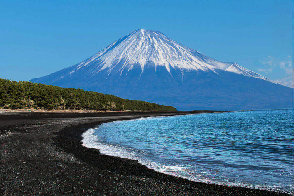
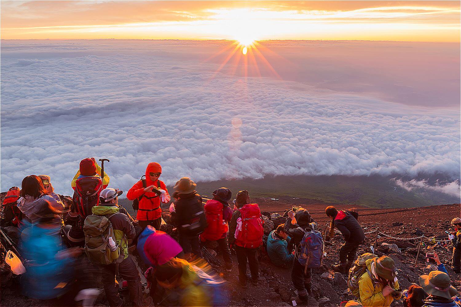
Best hiking trails: Mt. Fuji (Shizuoka Prefecture, Yamanashi Prefecture)
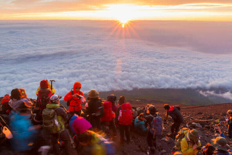
Crowds of climbers at the summit. Most Japanese climb the Fuji mountain at night in order to be in a position at or near the summit when the sun rises = shutterstock
Tour Programs of Mt.Fuji
Climbing to Mt. Fuji is limited from early July to mid September. During this period, a typhoon sometimes attacks, but if it is sunny, you can go to the top of the mountain through a mountain climbing route. Climbing routes can be roughly divided into Shizuoka prefecture side in the south and Yamanashi prefecture side in the north. The most common route recommended for beginners is the Yoshida route in Yamanashi Prefecture. If you use the Yoshida route, it will take about 7 hours from the 5th station to the summit. The downhill is about 4 hours. There are relatively many shops and mountain huts in this route.
If you climb Mt.Fuji, I strongly recommend that you take a nap in a mountain hut on the way and start climbing again in the late night. Then you can look at the splendid sunrise at the summit. I have seen the morning sun at the summit before. This morning sun is very beautiful, it should be a wonderful memory.
Climbing Mt. Fuji is quite different from climbing to Mt. Takao above. Mt.Fuji has an altitude of 3776 meters. Even climbing beginners can climb as climbing roads are maintained, but this mountain climbing is very tough. Furthermore, it is cold in the summer, near the summit. Please gather a lot of information in advance and prepare firmly.
>>Find the best deal, compare prices, and read what other travelers have to say at Tripadvisor!
Please also refer to the following article.


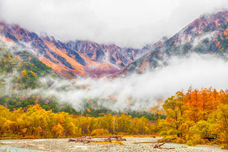
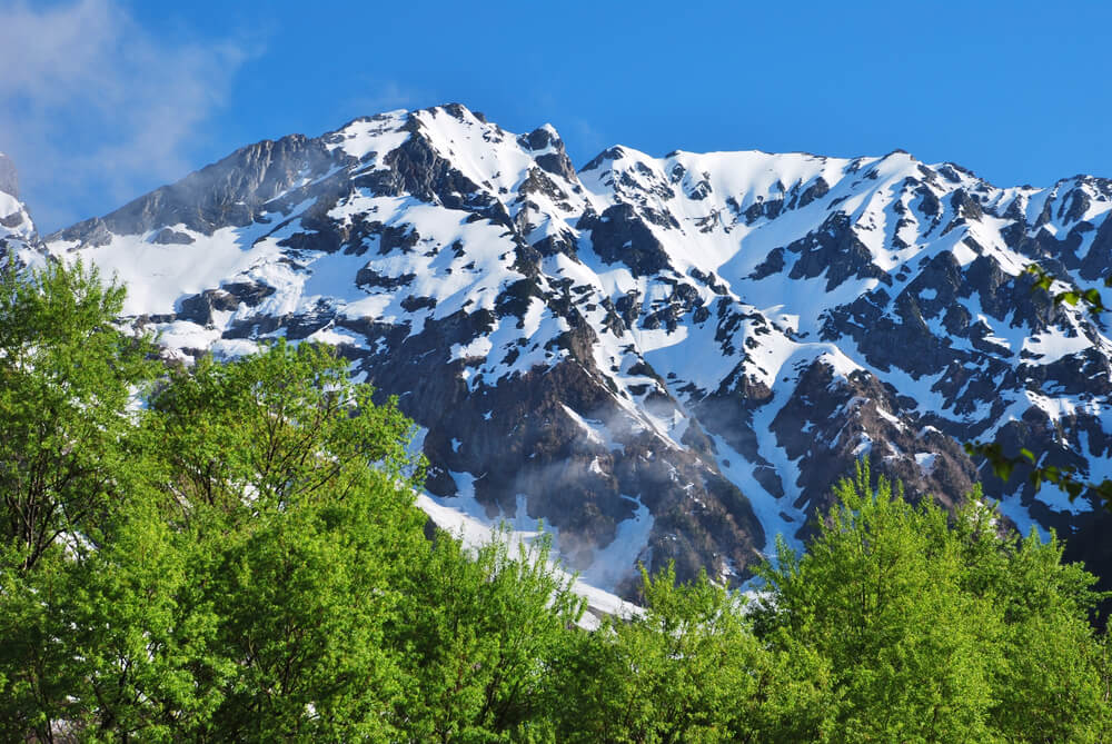
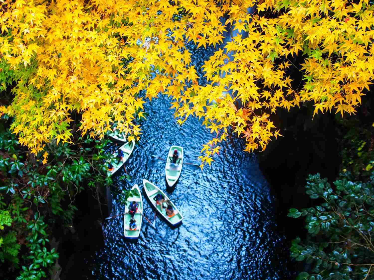
Best hiking trails: Kamikochi (Nagano Prefecture)
Kamikochi National Park in the Northern Japan Alps of Nagano Prefecture, Japan. Beautiful mountain in autumn leaf with river = shutterstock
Tour Programs of Kamikochi
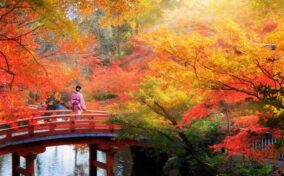
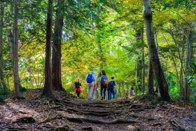
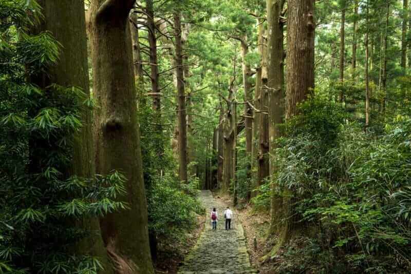
The picture at the beginning of this page is the scenery of Kamikochi.
Kamikochi is a plain with an altitude of 1,500 meters, embraced by mountains at an altitude of 3000 meters in the western part of Nagano Prefecture.
The plain has a width of up to 1 kilometer and a length of about 10 kilometers along the flow of the beautiful Azusa river. In the center of Kamikochi, there is a wooden suspension bridge named “Kappa Bridge”, and the scenery of the Azusa river with a kappa bridge is popular.
There are many walking streets in this plain. Since it is not permitted for a general vehicle to enter Kamikochi, the walking path is surprisingly quiet and beautiful. It seems that the surrounding mountains are very steep and as if coming out of paintings. Azusagawa is unbelievably clear. A mysterious forest such as a white birch spreads around the river.
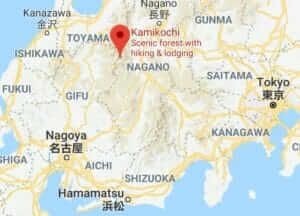
In Kamikochi you can enter from April 27th to November 15th. However, because passage of general vehicles is not permitted, you need to change to a bus or taxi at several parking lots near Kamikochi. Direct buses to Kamikochi are operated from JR Matsumoto Station and Matsumoto Electric Railway Shin-shimashima Station. Kamikochi is coolest in summer and is the best place to stay as a summer resort. During the winter months after November 16th, the temperature is very low and it is prohibited to enter because there is also much snow.
There are some famous hotels in Kamikochi. Among them, Kamikochi Imperial Hotel is a representative resort hotel in Japan and it is difficult to make a reservation. If you go to Kamikochi, I recommend that you prepare as soon as possible.
>>Find the best deal, compare prices, and read what other travelers have to say at Tripadvisor!
For Kamikochi, please see the beautiful photo feature below.
Best hiking trails: Fushimi Inari Taisha Shrine (Kyoto)
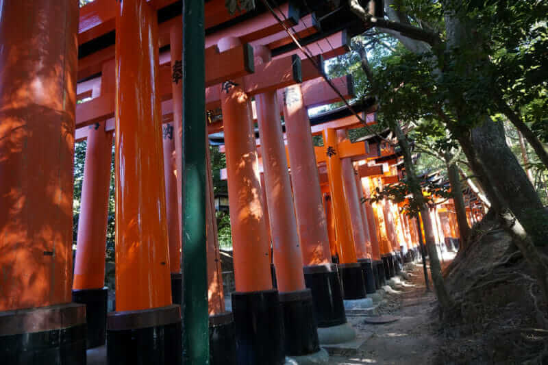
If you climb up to the summit of Fushimi Inari Taisha Shrine, you can see Kyoto city
Tour Programs of Fushimiinari Taisha Shrine
Fushimi Inari Taisha Shrine is the most popular tourist attraction among foreign tourists located in the south of Kyoto city. This shrine spreads to the top of Mt.Inari at an altitude of 233 meters. If you plan to sightsee this whole shrine, you will climb one mountain. From the top of the mountain you can look over the city of Kyoto. In the evening, you can see the amazing sunset landscape of the traditional city.
In Fushimi Inari Taisha Shrine there are 10,000 red torii. You will keep going up under these torii. It can be said that it is very Japanese-style hiking. It takes about 1 hour and 30 minutes from the foot to the top of Mt.Inari. Including breaks, it will take about 3 hours for round trip.
In the vicinity of the top, the staircase with a considerably steep slope continues. If you go with a child or senior citizen, it may be better to go back and do not overdo it.
>>Find the best deal, compare prices, and read what other travelers have to say at Tripadvisor!
Please also refer to the following article.

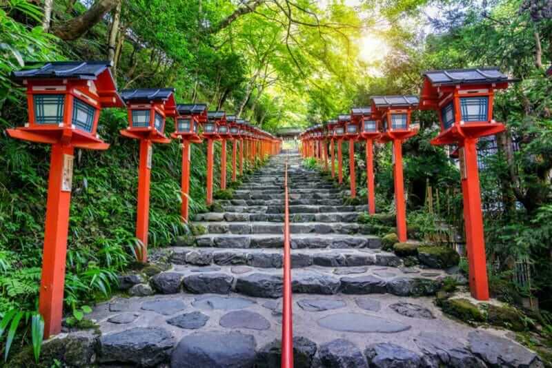
Best hiking trails: Kifune (Kyoto)
The red traditional light pole at Kifune shrine, Kyoto in Japan = shutterstock
Tour Programs of Kifune
Kifune is about 20 kilometers north of Kyoto station north and it is popular as a sightseeing spot in the outskirts of Kyoto with Kurama and Ohara nearby.
Kifune is a valuable place to enjoy the cultural atmosphere of Kyoto and the beautiful nature of Japan at the same time. There is a beautiful Kifune Shrine in a narrow valley between Mt.Kifune and Mt.Kurama. Why do not you hike while visiting this shrine?
Kifune Shrine is known as a landmark of autumn leaves. At the entrance of the shrine is a long staircase like the photo above. As red color traditional light poles are lined up around you, you should be able to take beautiful pictures. This staircase becomes pure white with snow in winter, giving a sacred atmosphere.
To Kifune shrine is about 30 minutes on foot from Kifuneguchi station of Eizan Railway. Because the bus is operated so close to the shrine, you can use it. Next to Kifune Shrine, I recommend going to the temples and shrines in Kurama and Ohara.
>>Find the best deal, compare prices, and read what other travelers have to say at Tripadvisor!

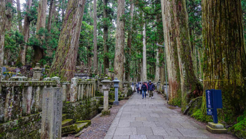
Best hiking trails: Kumano Kodo Pilgrimage Route
“Kumano Kodo” (Old pilgrimage road in Kumano district of Japan) = shutterstock
Tour Programs of Kumano Nachi Taisha Grand Shrine
Kumano Kodo is the ancient pilgrimage routes to the three Grand Shrines of Kumano (Kumano Hayatama Taisha Grand Shrine, Kumano Hongu Taisha Grand Shrine and Kumano Nachi Taisha Grand Shrine). There are many Kumano Kodo in the Kii Peninsula, Honshu’s largest peninsula. Every road is filled with a mysterious atmosphere. Why do not you walk these old roads?
In Japan it has been widespread to visit the three Grand Shrines of Kumano since ancient times. In the modern era, customs to worship these shrines were taken not only by the emperor and the nobility but also by the commoners. Many pilgrimage routes were prepared in this way. However, since the beginning of the 20th century, this custom was abandoned and the Kumano Kodo was also forgotten. However, some Kumano Kodo is still being used as a living road for locals.
Kumano Kodo was registered as a UNESCO World Heritage Site in 2004. Since then, activities to save Kumano Kodo in Japan are on the rise. In many sightseeing guide books, Kumano Kodo has been introduced. I think that you can get more information about Kumano Kodo on the Internet. However, depending on the site, only a part of Kumano Kodo is introduced. It is because local municipalities and tourism promotion groups etc. introduce many of Kumano Kodo in their own area. So, please be careful about that and collect information globally.
If you walk Kumano Kodo, I recommend that you also gather information about the three Grand Shrines of Kumano, the destinations of those paths. These three old shrines are very attractive. Therefore, I think that it will be the best trip when you set up an itinerary that goes to these shrines as well as Kumano Kodo.
>>Find the best deal, compare prices, and read what other travelers have to say at Tripadvisor!

Best hiking trails: Koyasan (Wakayama Prefecture)
Local people visit the Okunoin Cemetery on Mt. Koya (Koyasan) in Wakayama, Japan = shutterstock
Tour Programs of Koyasan
Koyasan is located in the northern part of Wakayama Prefecture, a basin with an altitude of 900 meters surrounded by mountains. In the 9th century, a famous monk, Kukai (also known as Kobo Daishi), made this basin a sacred place for Buddhism. Currently there are about 120 temples in Koyasan, centering on Kongobuji Temple. Koyasan was selected as a UNESCO World Heritage Site in 2004.
There are many sights in Koyasan, starting with Kongobuji Temple. However, Koyasan is very wide, and these sights are dotted in the area of 4 kilometers east-west and 2 kilometers north and south. Why do not you walk around these sights by walking along the way lined with big trees?
To Koyasan, you first go from the Namba station in Osaka to the nearest Gokuraku-bashi station by the limited express of Nankai railway. The journey takes approximately 90 minutes. Next you will go to Koyasan station by cable car. The journey time is 5 minutes. The inside of Koyasan is very wide, so the bus is orbiting. From Koyasan Station, take this bus and head to your destination.
There are several old roads to Koyasan around this basin. If you want to do a real hiking, it would be nice to walk on these old roads to Koyasan. Typical old roads are “Chouishi-michi” and “Kuroko-michi”.
>>Find the best deal, compare prices, and read what other travelers have to say at Tripadvisor!

Best hiking trails: Mt. Misen (Hiroshima Prefecture)
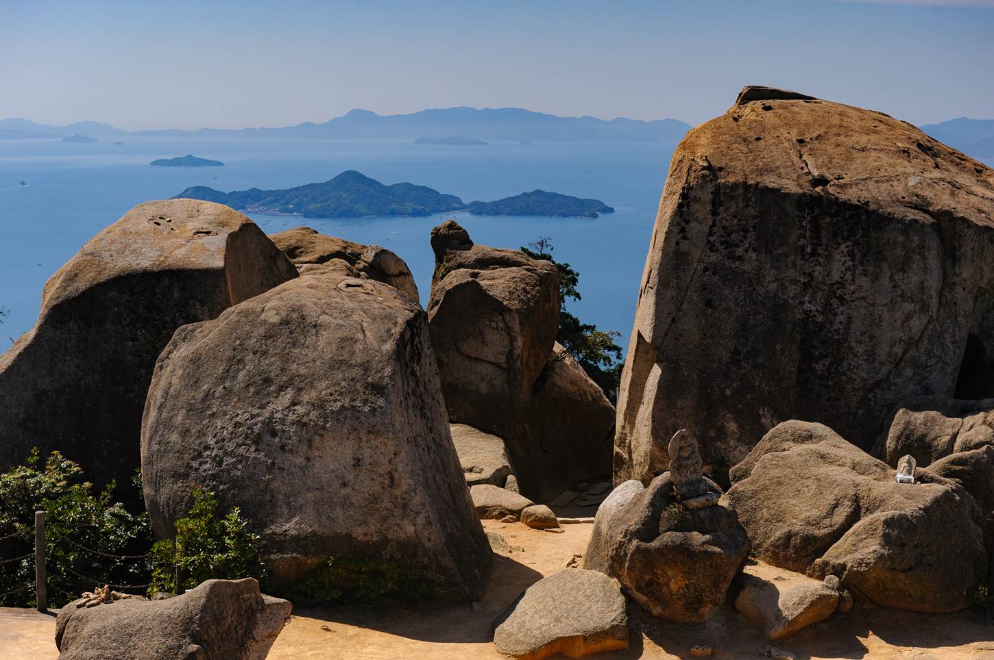
landscape of Miyajima in Seto Inland Sea, Japan = Shutterstock
Tour Programs of Mt.Misen, Miyajima
About 20 km southwest of Hiroshima City there is Miyajima Island. Miyajima Island is a small island about 30 km / l.
On this island there is Itsukushima Shrine registered as a UNESCO World Heritage Site. And the mountain rising behind it is Mt. Misen (535 meters above sea level).
Mt. Misen has won three stars with the Itsukushima Shrine in the Michelin Guide. From the observation deck of Mt. Misen you can see the surrounding seas and the mountains of Shikoku at the end. The scenery is really wonderful.
There are three climbing paths of Mt. Misen. You can climb to the top within 2 hours no matter which way you pass. In Mt. Misen there is a ropeway and you can also go to the middle of Mt. Misen by a ropeway. However, on crowded days such as weekends, there are times when it is around 30 minutes to get on the ropeway. If you are a healthy person, it may be more comfortable walking from the foot.
>>Find the best deal, compare prices, and read what other travelers have to say at Tripadvisor!

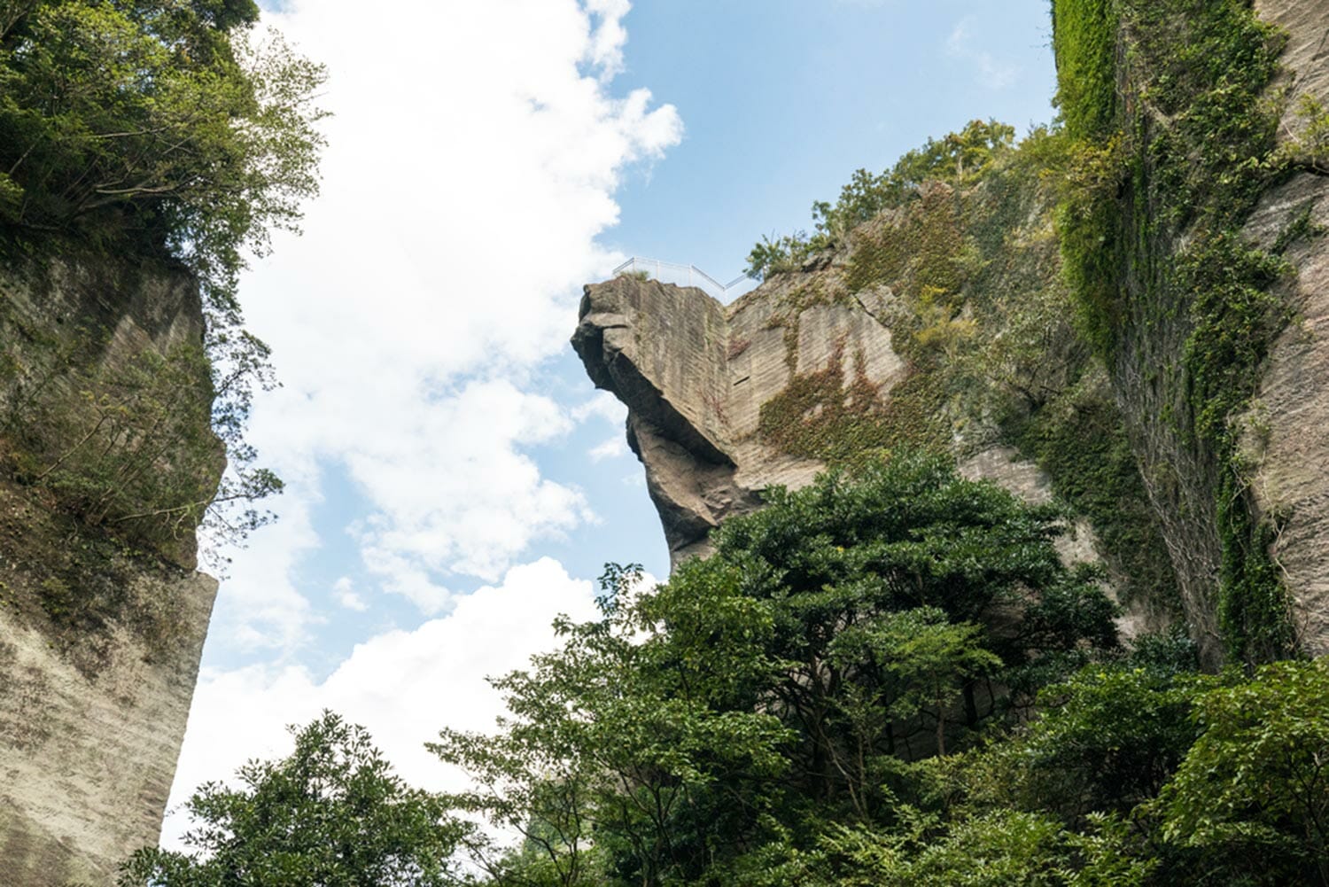
Best hiking trails: Takachiho Gorge (Miyazaki Prefectue)
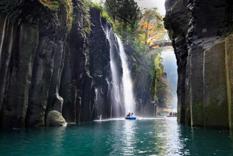
Manai Falls – Shrine of Japan,Takachiho Gorge = shutterstock
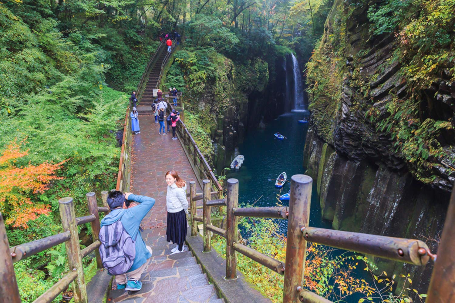
Along the Takachiho Gorge, about 1 km of promenade is being developed = shutterstock
Tour Programs of Takachihonomine
Takachiho Gorge is a famous sightseeing spot in eastern Kyushu. The Gogase River that flows through this area eroded the lava over a long period of time and built a deep valley. A cliff with a height of 80-100 meters lasts for 7 kilometers. Several waterfalls are flowing down the cliff. You can ride a boat until the waterfall.
Along this valley there is a promenade of about 1 km. Let’s park the car in the parking lot near the waterfall and walk on this promenade. The trees are green deeply, autumn leaves are beautiful. The sound of the waterfall feels good. You can fold back from the end of the boardwalk. Or you can go to a nearby Takachiho Shinto shrine.
Takachiho is said to be the hometown of Japanese myth. There are beautiful terraced paddy fields. Why do not you take a walk around such Takachiho and refresh?
>>Find the best deal, compare prices, and read what other travelers have to say at Tripadvisor!
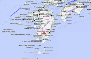
Best hiking trails: Yakushima Island (Kagoshima Prefecture)
Tour Programs of Yakushima
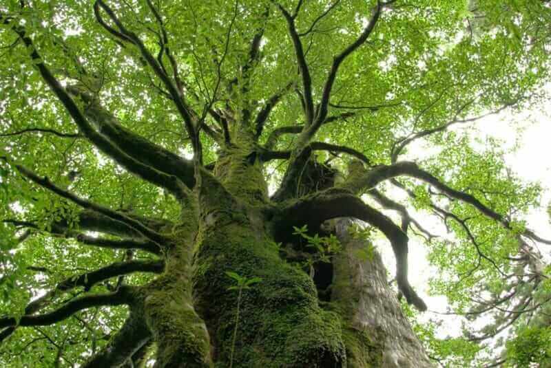
Yakushima island is located 60 km south of Kyushu. The approximately circular island of about 28 kilometers east-west and about 24 kilometers of north-south, 90% of the island is covered with forests. This island is famous for its many “Yakusugi” cedar trees over 1000 years old. The forests of Yakusugi etc. are registered as UNESCO World Heritage.
Yakushima is a truly wild island. Almost all of this island is a mountainous area, with mountains ranging in height from 1,000 to 1,900 meters. The annual rainfall is 4500 mm in coastal plains and over 10000 mm in mountainous areas. These rains become waterfalls and rivers, cut mountains and build deep valleys. I was surprised by heavy rain every day when I went to Yakushima. I felt that King Kong would appear.
Yakushima’s largest cedar is about 16 meters on a lap and is called “Jomon-sugi”. In Japan, we call the stone age “Jomon era”. This cedar tree has been named because its age exceeds 3000 years. You can take a tour on Yakushima going to see this cedar. The journey takes about 11 hours. Although it is a hard tour, the satisfaction level of the people participating in the tour is extremely high.
For details of Yakushima Island, please refer to the following sites.
>>Find the best deal, compare prices, and read what other travelers have to say at Tripadvisor!

Thank you for reading to the end.
Now, let’s plan to make your vacation in Japan the best experience ever!